


Dr. John Church and His Wonderful Drones


Consumer drones have become the hobby of choice for a growing number of eager video enthusiasts. The technology behind the drone and the camera payload has rapidly broken performance barriers in leaps and bounds. The explosion of digital video breaking past the HD barrier into the 4K realm has also meant the drones, or UAVs (Unmanned Aerial Vehicles), had to make technological strides with longer battery time and further flight range
Despite the controversial reputation drones have gotten from irresponsible use, there is a practical application to these small wonders that is making an undeniable mark in the agricultural world. Companies are springing up in the U.S. and Canada with advanced photographic and sensor technology that has given the agriculture industry an edge in precision farming.
That very concept is now being tested by Dr. John Church, an associate professor at Thompson Rivers University in Kamloops, BC, who is taking the drone to new heights with significant results, working specifically with the cattle industry. Church and his team are breaking new ground and have found that there is more to the drone than just an eye in the sky.
We (CMB) had an opportunity to speak with John Church (JC) about his program and what his thoughts were on the future of the drone on the ranch.
CMB: How did you get into cattle sustainability?
JC: My father was a participant in the Alberta cattle industry. So, I grew up around it, got my degrees in agriculture and biological sciences, and then came to Thompson Rivers University in Kamloops, which is right in the heart of the cattle industry in British Columbia. We’re not the most widely known but we are currently the fourth largest university in the province.
CMB: What is your title?
JC: I’m an associate professor in our natural resource science department and I’m also the chair for the British Columbia regional innovation for cattle industry sustainability.
CMB: Is that where the drone concept fit into your mandate?
JC: Yes, it absolutely did. A big part of my mandate is trying to develop new technologies and new techniques to help improve the cattle ranching industry and make life easier for the ranchers, so naturally I started thinking, “how can we use this for cows?”
CMB: What convinced you there was a practical correlation between drones and ranching?
JC: Back in 2013, I saw some kids playing with a drone in the park. It was a Parrot AR drone and I realized they could see what the drone sees. That intrigued me, the idea that you could use a drone to essentially extend your vision. To me that was ground breaking and I immediately started to think about the practical uses and how that fit into my mandate at the university.
CMB: So the first step was to focus on testing to extend rancher’s vision.
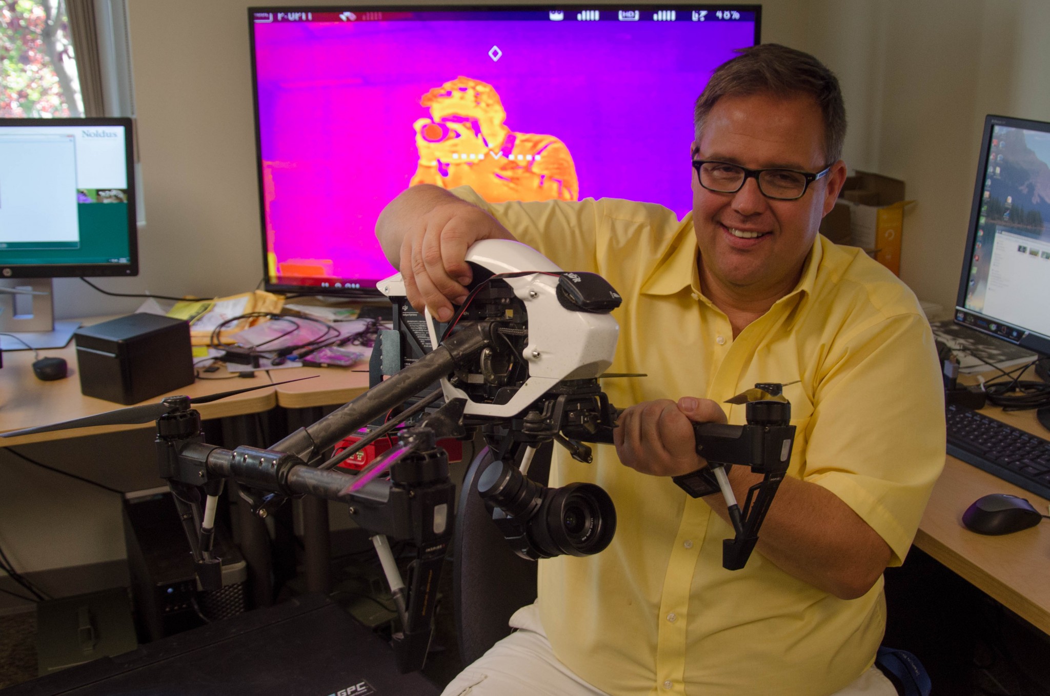
JC: Yes, that’s where it started. But I knew I could not look at it as a as a regular video but rather explore the idea of thermal to take the concept further. And if we incorporated infrared does that help you see cattle under the canopy? Can you use it to take temperature measures to find sick animals on the range or in the feedlot? Can it detect stress? We had a lot of trials to do, but early on the possibilities were endless.
CMB: Initially your research and testing was successful, because you’ve taken it further than that already.
JC: It was very successful actually. So much so that I started to think about radio frequency ID tags (RFID) so I went to a SAIT RFID conference where there was a research chair there and they were talking about RFID and I saw the possibility with drones. By that point I had successfully used drones and found lost animals, but once I found them, I still didn’t know which animal I was looking down at. So since the drones are all GPS stabilized and therefore can provide me the GPS coordinates of the cows, then the next logical step is; could we know which animal were looking at?
CMB: The possibilities must have been very exciting.
JC: Absolutely. The other part of this, which is covered in my grant, is the idea of using the drones as sensor platforms and doing what they call “photo orthomosaics”, essentially flying a grid and the drone basically flies autonomously and takes tons of photos of range land.
CMB: That’s utilizing the technology on a whole new level.
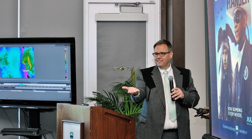
JC: Yes. Originally we started doing Mosaics of farmyards and creating 3D models. But then I figured out that we could use the drone to assess the pastures and perform the Normalized Difference Vegetation Index for example. So essentially the same drone we’re using to find the cattle can measure the pasture by simply changing the payload with a multispectral camera.
CMB: Are you running multiple cameras and sensors simultaneously during flight?
JC: Absolutely. For example we have a thermal camera we can put on so we can enhance the drone’s search functionality. The multispectral camera operates in the “near” infrared spectrum. So with that technology we can access pasture health and measure such things as the photo synthesis ability of the plants. At the same time the camera can determine bio mass, which to me is very intriguing.
CMB: Why is that intriguing?
JC: Before the start of the growing season, when the grass is really short, you can access bio mass, then later in the season, fly the drone again and track the increased volume. So by this we can quantify how much bio mass was actually in their pasture. Now we’re getting into precision farming practice. The other thing we’re looking towards is using the drones to find and manage weeds. The practical application to using drones is they can fly low and slow and completely stable to perform detailed tasks, which basically eliminates using airplanes or full scale helicopters for the task.
CMB: So what height are you nominally maintaining for your tests?
JC: We routinely fly at around 40 meters.
CMB: What is the flight time and range?
JC: That is getting better with every generation of drone. Advanced battery technology is increasing flight times to between 20 to 30 minutes. Even carry payload is improving substantially. The new Phantom 4 has incredible range. I believe a new generation is coming out – the DJI Mavic Pro – and those drones are able to do 7 kilometer range. Just imagine what that can do for today’s rancher.
CMB: Well besides herd and pasture health, it could result in huge operating cost savings.
JC: Exactly.
CMB: With all the Transport Canada regulations, how do you see that affecting practical use for agriculture?
JC: They do say that flying outside of line of sight is strictly prohibited, and if you’ve flown a drone you understand how challenging that can be because you can literally be out of line of sight within 30 seconds of deployment. But I think the big issue for Transport Canada is they want to ensure safety and cautionary use; meaning don’t fly in built up areas, respect airport traffic designations, and stay away from highways. What you have to remember is the ranchers we’re working with here in BC are pretty remote and keeping to their own ranges.
CMB: Are you working directly with ranchers which takes this from hypothetical testing to actual practical application.
JC: Yes, we’ve been working with Douglas Lake Cattle Company which I believe is the largest cattle ranch in Canada. Another partner is Jeff Braisher from Kingsclere Ranch and he is a very progressive rancher. Both have been very keen on what we’re doing with the drones. But we’ve also had other ranchers contact us to find missing cows on their ranges.
CMB: I would assume that type of search and report is basically done by camera feed to a monitor or mobile device?
JC: Yes, you can use the drone straight out of the box for that because we’re simply flying by RGB. We have used infrareds for that type of application, and there may be some instances where infrared might help, but when they go under the tree canopy, infrared still has a hard time seeing them. Another issue is that the average person has a hard time determining exactly what they’re looking at in the thermal spectrum, especially if there in among the trees. So, honestly, the RGB seems better for searching. Typically we fly around the hundred meter mark for such searches because you cover more ground. If we see something, then we have to lower altitude to confirm what we’re looking at. That can be time consuming. But optical zooms are coming out on the drones as well, so that is going to be a tremendous advancement for this type of application.
CMB: That is all very exciting when you think of what the science and technology of the drones and how practical they could be for ranchers and agriculture in general, but the other side of this is; you have to fly them.
JC: Yes, we crashed a lot in the early days to be honest. This was before we started using the DJI drones which are a lot more user friendly with respect to flying and operating and stabilizing.
CMB: One would think, considering the grants and funds for researching drones for agriculture use, that this really is the technology of the future.
JC: Exactly. I know the University of Saskatchewan received considerable funding for looking at crops and that is simply because drones have become a large part of the conversation when it comes to precision agriculture. Satellite imagery and airplane fly overs just can’t provide the spatial resolution that you need, nor can you get it timely enough to make management decisions. But if you have a drone – or fleet – then the rancher or farmer can fly their own pastures as often and low as they need. And there is mapping software as well that ensures you can get that precision visual to better inform your management decisions. I believe you can load your GIS map that the drone creates right into your tractor computer to guide precision spraying. This is all ground breaking.
CMB: How far can we go? Will this replace good ol’ farm know how?
JC: No. Ranchers do an amazing job of eyeballing their pastures, but that is not a science. What we would like to do is give those ranchers quantitative tools to better help them ‘eyeball’ what is going on in their fields and on their ranch. This is key to the success of this technology.
CMB: Did the grant you received cover the concept overall or a specific component to using drones for precision cattle farming?
JC: We received over $1 million for funding and the two biggest components of the program are: developing an antenna that can expand the functionality of the RFID tag. Currently we’re testing two different tags. A passive, ultrahigh frequency ID tag that emits at a range of about 40 feet that the drone can detect. The actual tag is somewhat similar to what is in the animal’s ears now, but those tags only emit about 1.5 meters.
CMB: This technology is a real game changer for the agricultural industry.
JC: I can’t think of any other business or industry where you have that much value in your livestock inventory and where there are such high risk factors in this region of BC with predators such as grizzlies, wolves or cougars. My concept has always been what you could term “precision ranching” and developing the technology to ensure the rancher knows exactly where their cattle are and better monitor and maintain their grazing cycles, protection, and essentially have the right animal in the right place at the right time.
CMB: How about the idea that the drones could even be used for herding?
JC: We have tried that. We’ve done studies where we habituated the animals to the drones and we found we could fly to around 8 meters of them. Typically they will react when they feel the prop wash. Yet with some of them, I feel like I could land right on them because they had become so accustomed to the drone hovering. We have been able to herd them about 10 kilometers out using just one drone. You mentioned cutting operating costs earlier as well, that is usually a three man job. Nonetheless we could direct them where we needed them to go.
CMB: The drone could be an invaluable tool for the rancher.
JC: We think so. How many ranchers would like to avoid the 4:00 am calving check way out in the back range when they could just stand out on the porch, even have the GPS tracking locked on a particular animal with a solar tag, and the drone just flies off, finds the animal, checks to make sure she’s not calving in the middle of the night. That would be a lot nicer than being out there with a flashlight when an infrared or thermal camera equipped drone can do it.
CMB: What is the end goal for you?
JC: Our goals are two-fold. First to have a drone that not only can access pastures with a multispectral camera to perform precision remote sensing and facilitate effective ranch management decisions with respect to pastures and herd health. Second is to develop the high frequency antenna so drones can receive long-range RFID identification signals. I see a day where the rancher could click on the RFID number on their laptop, iPhone, or whatever device they’re using, and the drone will launch and fly and search for that specific animal and send back real time location status. To be honest we’re just scratching the surface. Imagine what we could do – and our computer science division with Dr. Musfiq Rahman is working with us on this – to use the proposed 5G network infrastructure – typically WiFi – that would provide unprecedented data communication and give the drones unlimited video streaming and flying range. If we could configure control of the drone over 5G that would be incredible.
For more information, visit www.tru.ca/
Our June 2025 Issue

In our June 2025 issue,JBS Dual Stock listing, FCC announces $2 billion investment, U.S. livestock lose to China tariffs, Removing GST from foods, the New Pork campaign, Farm and Food Ontario announces new funding, what is Agritourism, and much more!


